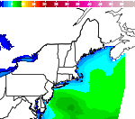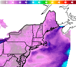


For More Weather Information:
Monday

High: 61 °F
⇑S 6kt
2ftMonday Night

Low: 56 °F
SW 6kt
2ftTuesday

High: 61 °F
⇑SSW 12kt
2-3ftTuesday Night

Low: 57 °F
SW 11kt
3ftWednesday

High: 63 °F
SSW 9kt
3ftWednesday Night

Low: 57 °F
SSW 7kt
2-3ftThursday

High: 61 °F
S 9kt
2ftThursday Night

Low: 58 °F
SSW 11kt
3ftFriday

High: 62 °F
SSW 13kt
3-4ft
High and low forecast temperature values represent air temperature.
Associated Zone Forecast which includes this point
Last Update: 3:26 am EDT Jul 8, 2024
Forecast Valid: 4am EDT Jul 8, 2024-6pm EDT Jul 14, 2024
View Nearby Observations
Detailed Forecast
Monday
Variable winds less than 5 kt becoming S around 6 kt in the afternoon. Areas of fog before 8am, then Areas of fog after 9am. Seas around 2 ft.
Monday Night
SW wind around 6 kt. Areas of fog. Seas around 2 ft.
Tuesday
SSW wind 6 to 9 kt increasing to 9 to 12 kt in the afternoon. Patchy fog. Seas 2 to 3 ft.
Tuesday Night
SW wind 9 to 11 kt. A chance of showers, mainly between 7pm and 5am. Patchy fog. Seas around 3 ft.
Wednesday
SSW wind 6 to 9 kt. A slight chance of showers before 11am, then a slight chance of showers after noon. Patchy fog. Seas around 3 ft.
Wednesday Night
SSW wind around 7 kt. A chance of showers. Patchy fog. Seas 2 to 3 ft.
Thursday
S wind 7 to 9 kt. Showers likely and possibly a thunderstorm before 1pm, then a chance of showers and thunderstorms between 1pm and 2pm, then a chance of showers after 2pm. Patchy fog. Seas around 2 ft.
Thursday Night
SSW wind 9 to 11 kt, with gusts as high as 17 kt. A chance of showers, with thunderstorms also possible after 8pm. Patchy fog. Seas around 3 ft.
Friday
SSW wind around 13 kt, with gusts as high as 19 kt. A chance of showers and thunderstorms before 2pm, then a slight chance of showers. Patchy fog. Seas 3 to 4 ft.
*Notices:
- This forecast is for a single location. For safety concerns, mariners should be aware of the weather over a larger area. Forecast information for a larger area can be found within the zone forecast and the NDFD graphics.
- The forecast conditions at a particular point may not exceed the criteria of a Small Craft Advisory, Gale, Storm etc. These watches/warnings/advisories are issued for the entire zone in which the point resides and mariners should act accordingly.
Additional Forecasts and Information
Select Another Point
ABOUT THIS FORECAST
| Point Forecast: | 44.37°N 67.67°W |
| Last Update: | 3:26 am EDT Jul 8, 2024 |
| Forecast Valid: | 4am EDT Jul 8, 2024-6pm EDT Jul 14, 2024 |
| Forecast Discussion | |
|
|


