

Cold Temperatures for the Eastern U.S.; Lake Effect Snow in the Great Lakes; Heavy Rain in the Pacific Northwest
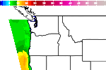
Cold temperatures will continue across much of the eastern U.S. into today. Heavy lake effect snow continues into today east of Lakes Erie and Ontario. Two Pacific cold fronts will cross the Pacific Northwest early this week followed by another atmospheric river. Heavy rain and gusty winds are expected through midweek, with the potential for renewed urban and river flooding. Read More >

Hazardous Weather Conditions
Last Update: 202 PM PST Mon Dec 15 2025
For More Weather Information:
19NM NW Brookings OR
Marine Zone Forecast
...HAZARDOUS SEAS WARNING IN EFFECT UNTIL 4 PM PST THIS AFTERNOON......SMALL CRAFT ADVISORY IN EFFECT THROUGH TUESDAY AFTERNOON... ...HAZARDOUS SEAS WARNING IN EFFECT FROM TUESDAY AFTERNOON THROUGH LATE TUESDAY NIGHT...
Tonight
S wind 15 to 20 kt with gusts up to 25 kt, easing to 10 to 15 kt late this evening and overnight. Seas 10 to 12 ft. Wave detail: SW 4 ft at 6 seconds and W 11 ft at 13 seconds. Rain with isolated tstms early this evening, then rain likely late this evening and overnight.
Tue
S wind 15 to 20 kt, rising to 20 to 25 kt in the afternoon. Seas 9 to 11 ft. Wave detail: S 4 ft at 5 seconds and W 11 ft at 12 seconds. Rain.
Tue Night
S wind 20 to 25 kt, veering to W after midnight. Gusts up to 35 kt. Seas 10 to 14 ft. Wave detail: SW 7 ft at 7 seconds and SW 11 ft at 12 seconds. Rain.
Wed
NW wind 5 to 10 kt, backing to SW in the afternoon. Seas 11 to 13 ft. Wave detail: W 6 ft at 7 seconds and W 12 ft at 11 seconds. Rain, mainly in the morning.
Wed Night
SE wind 10 to 15 kt, becoming S 20 to 25 kt with gusts up to 35 kt after midnight. Seas 9 to 12 ft. Wave detail: W 8 ft at 6 seconds and W 11 ft at 11 seconds. Rain.
Thu
S wind 25 to 30 kt with gusts up to 45 kt. Seas 12 to 16 ft. Wave detail: SW 12 ft at 8 seconds and NW 10 ft at 11 seconds. Rain.
Thu Night
S wind 25 to 30 kt with gusts up to 40 kt. Seas 13 to 17 ft. Wave detail: SW 12 ft at 8 seconds and W 10 ft at 10 seconds. Rain.
Fri
SW wind 15 to 20 kt, becoming NW 10 to 15 kt in the afternoon. Seas 12 to 14 ft, subsiding to 10 to 13 ft in the afternoon. Wave detail: SW 11 ft at 8 seconds, W 9 ft at 11 seconds and NW 6 ft at 13 seconds. Rain.
Fri Night
NW wind 10 to 15 kt, easing to 5 to 10 kt after midnight. Seas 8 to 11 ft, subsiding to 7 to 9 ft after midnight. Wave detail: NW 3 ft at 5 seconds, W 8 ft at 10 seconds and NW 7 ft at 12 seconds. Rain likely, mainly in the evening.
Sat
S wind 5 to 10 kt, veering to SW in the afternoon. Seas 7 to 8 ft. Wave detail: SW 2 ft at 4 seconds, SW 5 ft at 10 seconds and NW 7 ft at 12 seconds. A chance of rain in the morning, then rain likely in the afternoon.
Sat Night
S wind 5 to 10 kt. Seas 7 to 8 ft. Rain.
winds and seas higher in and near tstms.
winds and seas higher in and near tstms.
Basemap Options
Click map to change the forecast location
Loading map...


