
Thunderstorms and Heavy Rainfall in the Mississippi Valley; Heavy Rain Continues in Southeast Florida
A cold front approaching the Mississippi Valley will bring heavy rainfall and isolated severe thunderstorms to the region. Thunderstorms will have the potential to produce isolated severe wind gusts and perhaps a brief tornado or two. Scattered to numerous showers and storms will bring another day of localized flooding to south Florida. Read More >

Current conditions at
Quillayute, Quillayute State Airport (KUIL)
Lat: 47.9375° N Lon: 124.555° W Elev: 194.0 ft.
Overcast
45°F
7°C
| Humidity | 96% |
| Wind Speed | E 3 MPH |
| Barometer | 30.03 in (1016.93 mb) |
| Dewpoint | 44°F (7°C) |
| Visibility | 10.00 mi |
| Last update | 03 Nov 03:53 AM PST |
Detailed forecast for
Northern Washington Coast
Today
Mostly cloudy until late afternoon then becoming mostly sunny. A slight chance of showers. Highs in the 50s. East wind 10 to 15 mph decreasing to 10 mph or less in the afternoon.
Tonight
Mostly clear. Lows in the 40s. East wind to 10 mph becoming southeast after midnight.
Wednesday
Mostly cloudy until late afternoon, then a chance of rain late in the afternoon. Highs in the 50s. Southeast wind 10 to 20 mph. Gusts to 30 mph in the afternoon.
Wednesday Night
Breezy, rain. Rainfall amounts a quarter to a half inch possible. Lows in the mid 40s to lower 50s. Southeast wind 15 to 25 mph becoming south 10 to 15 mph after midnight.
Thursday
Mostly cloudy with a chance of rain. Highs in the lower to mid 50s. Southwest wind to 10 mph increasing to south 10 to 20 mph in the afternoon.
Thursday Night
Windy. Rain at times in the evening, then showers and a slight chance of thunderstorms after midnight. Lows in the mid to upper 40s.
Friday
Windy. Rain at times. Highs in the mid 50s.
Friday Night
Mostly cloudy with rain likely in the evening, then cloudy with a chance of rain after midnight. Lows in the 40s.
Saturday
Breezy. Rain likely. Highs in the mid to upper 50s.
Saturday Night
Windy, rain. Lows in the mid 40s to lower 50s.
Sunday
Windy. Mostly cloudy with rain likely in the morning, then mostly cloudy with a chance of rain in the afternoon. Highs in the lower to mid 50s.
Sunday Night
Mostly cloudy with a chance of rain. Lows in the lower to mid 40s.
Monday
Windy. Mostly cloudy with a chance of rain in the morning, then mostly cloudy with rain likely in the afternoon. Highs in the lower to mid 50s.
Basemap Options
Click map to change the forecast location
Loading map...
 Forecast Area
Additional Resources
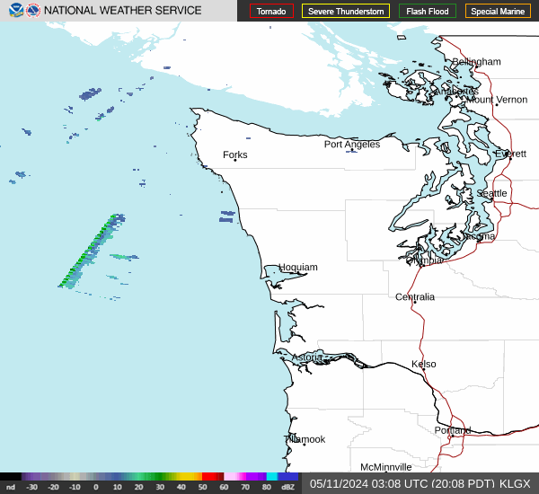
Radar & Satellite Image

Hourly Weather Forecast