
Severe Weather and Heavy Rainfall in the Plains Tonight; Heavy Rainfall and Flooding Along the East Coast of Florida
Severe thunderstorms with the potential for strong, damaging winds and a few tornadoes are expected through tonight across the central and southern Plains. Heavy rainfall may accompany these thunderstorms. Heavy rainfall will continue through tonight along the east coast of Florida and flooding will continue through Tuesday morning. Read More >

Current conditions at
W7KKE-3 Road's End (AP682)
Lat: 45.011° N Lon: 124.00583° W Elev: 102.39 ft.NA
51°F
11°C
| Humidity | 83% |
| Wind Speed | E 1 MPH |
| Barometer | 29.87 in (1011.51 mb) |
| Dewpoint | 46°F (8°C) |
| Visibility | NA |
| Last update | 03 Nov 03:23 AM PST |
Detailed forecast for
Central Coast of Oregon
Rest Of Tonight
Cloudy. Lows in the mid 40s. Winds light.
Tuesday
Mostly cloudy in the morning, then clearing. Highs in the lower 60s. Winds light.
Tuesday Night
Mostly clear in the evening, then becoming partly cloudy. Patchy fog. Lows in the lower 40s. Light and variable winds, becoming light after midnight.
Wednesday
Partly sunny in the morning, then rain in the afternoon. Highs in the upper 50s. South wind 5 to 10 mph. Chance of rain near 100 percent.
Wednesday Night
Rain, mainly in the evening. Patchy fog after midnight. Lows in the upper 40s. Southwest wind 5 to 10 mph. Chance of rain near 100 percent.
Thursday
Partly sunny. Highs in the upper 50s.
Thursday Night
Mostly cloudy with a 50 percent chance of rain. Patchy fog. Lows in the mid 40s.
Friday
Mostly cloudy with a 50 percent chance of rain. Highs around 60.
Friday Night
Mostly cloudy with a 40 percent chance of rain. Patchy fog. Lows in the upper 40s.
Saturday
Mostly cloudy with a 40 percent chance of rain. Highs in the mid 60s.
Saturday Night
Rain likely. Lows around 50. Chance of rain 70 percent.
Sunday
Mostly cloudy in the morning, then becoming partly sunny. Rain likely. Highs in the upper 50s. Chance of rain 70 percent.
Sunday Night
Mostly cloudy with a 20 percent chance of rain. Patchy fog. Lows in the upper 40s.
Monday
Cloudy with a 50 percent chance of rain. Highs in the upper 50s.
Additional Forecasts and Information
Basemap Options
Click map to change the forecast location
Loading map...
 Forecast Area
Additional Resources
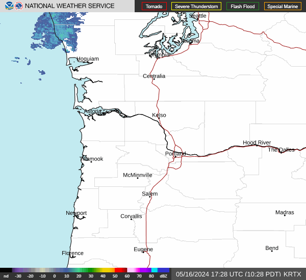
Radar & Satellite Image

Hourly Weather Forecast