


Areas of Excessive Heat and Severe Thunderstorms Today.
Hot to excessively hot temperatures are expected today for much of the Midwest including the Chicago and Milwaukee Metros, and a part of the Mid-Atlantic including the Philadelphia Metro, also the southern tip of Florida and a part of Puerto Rico. Severe thunderstorms are possible across the Great Lakes region and portions of the Midwest today. Damaging winds and hail are the primary threats. Read More >

Current conditions at
Carroll County Regional Jack B Poage Field (KDMW)
Lat: 39.61° N Lon: 77.01° W Elev: 789 ft.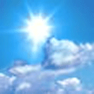
Fair
88°F
31°C
| Humidity | 46% |
| Wind Speed | SW 6 mph |
| Barometer | 30.14 in |
| Dewpoint | 64°F (18°C) |
| Visibility | 10.00 mi |
| Heat Index | 90°F (32°C) |
| Last update | 27 Aug 1:25 pm EDT |
Detailed forecast for
Northern Baltimore
This Afternoon
Sunny. Highs in the upper 80s. West winds around 5 mph.
Tonight
Mostly clear in the evening, then becoming partly cloudy. Lows around 70. South winds around 5 mph.
Wednesday
Sunny. A slight chance of showers and thunderstorms in the afternoon. Hot with highs in the mid 90s. West winds 5 to 10 mph. Chance of rain 20 percent.
Wednesday Night
Mostly cloudy in the evening, then becoming partly cloudy. A chance of showers and thunderstorms. Lows in the lower 70s. Northwest winds 5 to 10 mph, becoming north after midnight. Chance of rain 40 percent.
Thursday
Partly sunny. A chance of showers in the afternoon. Highs in the lower 80s. Northeast winds around 5 mph. Chance of rain 40 percent.
Thursday Night
Mostly cloudy with a chance of showers and thunderstorms. Lows in the mid 60s. Chance of rain 40 percent.
Friday
Mostly cloudy. Highs in the mid 70s.
Friday Night
Mostly cloudy. Lows in the mid 60s.
Saturday
Mostly cloudy with a chance of showers and thunderstorms. Highs in the lower 80s. Chance of rain 50 percent.
Saturday Night
Mostly cloudy with a chance of showers and thunderstorms. Lows in the upper 60s. Chance of rain 50 percent.
Sunday
Mostly sunny with a 30 percent chance of showers. Highs in the mid 80s.
Sunday Night
Partly cloudy. Lows in the mid 60s.
Labor Day
Mostly sunny. Highs in the upper 70s.
Additional Resources
Radar & Satellite Image


Hourly Weather Forecast


