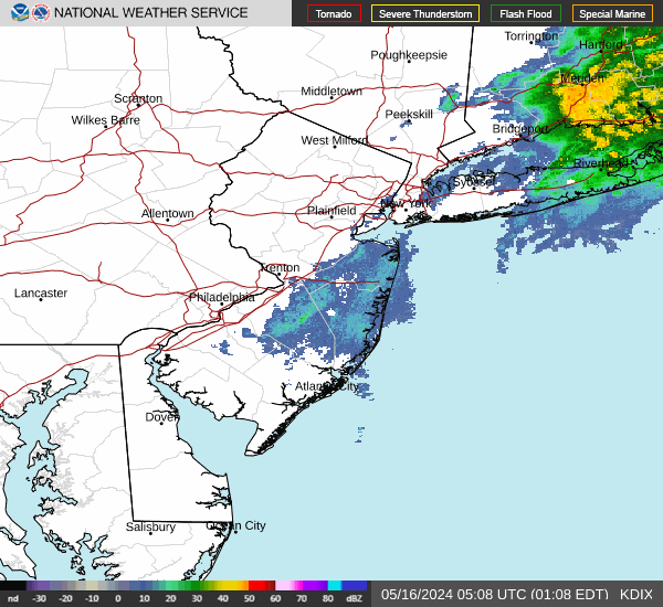


Light Wintry Mix through This Morning, then a Winter Storm Anticipated Sunday into Monday
Briefing on this morning's icing in the southern Poconos and NW NJ, as well as potential impacts from a winter storm Sunday into Monday. Read More >

Hazardous Weather Conditions
Last Update: 403 PM EST Fri Feb 20 2026
For More Weather Information:
31NM SSE New York NY
Marine Zone Forecast
...SMALL CRAFT ADVISORY IN EFFECT THROUGH LATE TONIGHT... ...GALE WATCH IN EFFECT FROM SUNDAY EVENING THROUGH MONDAY AFTERNOON...
Tonight
NW winds 5 to 10 kt, becoming W 10 to 15 kt with gusts up to 20 kt after midnight. Seas 4 to 5 ft. Wave detail: E 5 ft at 7 seconds. A chance of drizzle until early morning. Areas of fog until early morning. Vsby 1 to 3 nm until early morning.
Sat
W winds 10 to 15 kt with gusts up to 20 kt, becoming NW 5 to 10 kt in the afternoon. Seas 2 to 4 ft. Wave detail: SE 4 ft at 7 seconds.
Sat Night
NW winds 5 to 10 kt, becoming E 10 to 15 kt with gusts up to 20 kt after midnight. Seas 2 to 3 ft. Wave detail: NE 2 ft at 7 seconds and S 2 ft at 7 seconds. A chance of rain after midnight.
Sun
E winds 15 to 20 kt, increasing to 25 to 30 kt in the afternoon. Seas 3 to 5 ft, building to 5 to 8 ft in the afternoon. Wave detail: E 5 ft at 6 seconds and S 1 foot at 7 seconds, becoming SE 8 ft at 7 seconds. Rain and snow likely in the morning, then snow in the afternoon.
Sun Night
NE winds 25 to 30 kt, increasing to 30 to 35 kt after midnight. Seas 8 to 11 ft, building to 10 to 14 ft after midnight. Wave detail: E 11 ft at 9 seconds, becoming E 14 ft at 11 seconds. Snow.
Mon
N winds 25 to 35 kt. Seas 11 to 14 ft, subsiding to 9 to 13 ft in the afternoon. Wave detail: E 14 ft at 11 seconds, becoming E 10 ft at 11 seconds. Snow, mainly in the morning.
Mon Night
NW winds 15 to 20 kt with gusts up to 25 kt. Seas 6 to 9 ft, subsiding to 4 to 6 ft after midnight.
Tue
NW winds 15 to 20 kt. Seas 3 to 5 ft.
Tue Night
W winds 10 to 15 kt, becoming SW 5 to 10 kt after midnight. Seas 2 to 3 ft.
Wed
SW winds 10 to 15 kt. Seas 2 to 3 ft, building to 4 to 6 ft in the afternoon.
Wed Night
SW winds 10 to 15 kt. Seas 4 to 6 ft. A chance of rain.
Additional Forecasts and Information
Basemap Options
Click map to change the forecast location
Loading map...


