Logotipo de NOAA - Clic para la página de NOAAPronóstico del Servicio Nacional de MeteoroligíaLogotipo del NWS
Coastal waters from Savannah GA to Altamaha Sound GA out 20 nm ...including Grays Reef National Marine Sanctuary (AMZ354) - Atlantic OceanPronóstico detallado para 7-días
"Ciudad, Edo." o código postal   
Bookmark and Share 
NWS
Zone Forecast: Coastal waters from Savannah GA to Altamaha Sound GA out 20 nm ...including Grays Reef National Marine Sanctuary (AMZ354)
Mobile Weather Information

Acutalizada: 1010 AM EDT MON JUN 20 2016
Marine Zone Forecast
Synopsis...HIGH PRESSURE WILL PREVAIL INTO MID WEEK BEFORE SHIFTING SOUTH AND GIVING WAY TO A TROUGH OF LOW PRESSURE THROUGH LATE WEEK. A COLD FRONT WILL ADVANCE INTO THE REGION SATURDAY AND WILL LIKELY STALL OVER OR CLOSE TO THE AREA THROUGH SUNDAY. THE STATIONARY FRONT SHOULD THEN DISSIPATE EARLY NEXT WEEK.

Rest Of Today...NE winds 10 to 15 kt...becoming E. Seas 2 to 4 ft. A slight chance of showers late this morning.

Tonight...SE winds 5 to 10 kt...becoming S after midnight. Seas 3 to 4 ft...subsiding to 2 to 3 ft after midnight.

Tue...SW winds 5 to 10 kt...becoming S 10 to 15 kt in the afternoon. Seas 2 ft.

Tue Night...S winds 15 kt. Seas 2 to 3 ft.

Wed...SW winds 15 kt. Seas 2 ft.

Wed Night...S winds 15 kt. Seas 2 to 3 ft.

Thu...SW winds 10 to 15 kt. Seas 2 ft.

Thu Night...S winds 10 to 15 kt. Seas 3 to 4 ft.

Fri...SW winds 10 to 15 kt. Seas 2 to 3 ft.

Fri Night...SW winds 10 to 15 kt. Seas 3 to 4 ft. A slight chance of showers and tstms.

mariners are reminded that winds and seas can be higher in and near tstms.


Pronóstico detallado por punto Mueve el mapa del pronóstico abajo, y condiciones actuales, radar, y satelíte arriba.Tiempo local actualMueve el mapa del pronóstico abajo, y condiciones actuales, radar, y satelíte arriba.
41008 GRAYS REEF - 40 NM Southeast of Savannah
Lat: 31.4°N   Lon: 80.87°W   Elev: 0

Not a Current Observation

Nearby
Observations


Past
Observations
Wind: NA
Pressure: NA
Air Temperature: NA
Water Temperature: NA
Dewpoint: NA
Wave Hgt/Dir: NA
Dominant Wave Period: NA
Visibility: NA

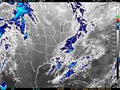
Radar y Satélite (Clic para imagén más grande)
Link to Local Radar Data Link to Satellite Data

Base Nacional de Pronósticos Digitales (Clic para imagen más grande)
Base de datos del Pronóstico digital, Pronóstico de la Temperature MáximaPronóstico de los Meteoros del Base de datos del Pronóstico digital
Pronósticos e Información Adicional
Forecast Discussion
National Marine ForecastsTide Information
Pronóstico Imprimible Texto del Pronóstico
No todos estos enlaces son traducidos al español

Webmaster
Servicio Nacional de Meteorología de:
www.weather.gov
Política de Confidencialidad
Condiciones de Uso
Créditos