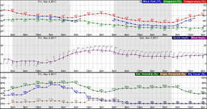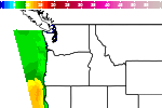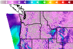

Thunderstorms and Heavy Rainfall in the Mississippi Valley; Heavy Rain Continues in Southeast Florida
A cold front approaching the Mississippi Valley will bring heavy rainfall and isolated severe thunderstorms to the region. Thunderstorms will have the potential to produce isolated severe wind gusts and perhaps a brief tornado or two. Scattered to numerous showers and storms will bring another day of localized flooding to south Florida. Read More >

Hazardous Weather Conditions
For More Weather Information:
This Afternoon

Light Wind
8ftTonight

Light Wind
8-9ftWednesday

⇑SSW 14kt
7-8ftWednesday Night
SW 12kt⇓
5-6ftThursday
Light Wind
8-9ftThursday Night
Light Wind
10ftFriday
SSW 6kt
10-12ftFriday Night
Light Wind
12ftSaturday
⇑SSW 10kt
10-11ft
Associated Zone Forecast which includes this point
Last Update: 12:11 pm PST Nov 3, 2026
Forecast Valid: 1pm PST Nov 3, 2026-6pm PST Nov 9, 2026
View Nearby Observations
Detailed Forecast
*Notices:
- This forecast is for a single location. For safety concerns, mariners should be aware of the weather over a larger area. Forecast information for a larger area can be found within the zone forecast and the NDFD graphics.
- The forecast conditions at a particular point may not exceed the criteria of a Small Craft Advisory, Gale, Storm etc. These watches/warnings/advisories are issued for the entire zone in which the point resides and mariners should act accordingly.
Additional Forecasts and Information
 Forecast Area
ABOUT THIS FORECAST
| Point Forecast: | 43.67°N 124.21°W |
| Last Update: | 12:11 pm PST Nov 3, 2026 |
| Forecast Valid: | 1pm PST Nov 3, 2026-6pm PST Nov 9, 2026 |
| Forecast Discussion | |


|
RADAR & SATELLITE IMAGES