


Hazardous Weather Conditions
Current conditions at
Orlando Executive Airport (KORL)
Lat: 28.55°NLon: 81.34°WElev: 102ft.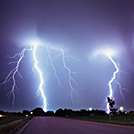
Thunderstorm in Vicinity Light Rain
76°F
24°C
| Humidity | 97% |
| Wind Speed | W 8 mph |
| Barometer | 30.06 in (1018.1 mb) |
| Dewpoint | 75°F (24°C) |
| Visibility | 10.00 mi |
| Heat Index | 75°F (24°C) |
| Last update | 8 Jul 8:53 pm EDT |
Extended Forecast for
Holden Heights FL
Tonight
Low: 78 °F
Chance
T-storms then
Mostly CloudyTuesday
High: 90 °F
Chance
T-storms then
T-storms
LikelyTuesday Night

Low: 76 °F
T-storms
LikelyWednesday

High: 91 °F
T-storms
LikelyWednesday Night
Low: 76 °F
T-storms
LikelyThursday
High: 92 °F
T-storms
LikelyThursday Night
Low: 76 °F
T-storms
Likely then
Chance
T-stormsFriday
High: 93 °F
Chance
T-storms then
T-storms
LikelyFriday Night
Low: 77 °F
T-storms
Likely then
Slight Chance
T-storms
Detailed Forecast
Tonight
A 40 percent chance of showers and thunderstorms, mainly before 11pm. Mostly cloudy, with a low around 78. North northwest wind around 5 mph becoming calm in the evening.
Tuesday
Showers and thunderstorms likely, mainly after 3pm. Partly sunny, with a high near 90. West wind around 5 mph. Chance of precipitation is 60%. New rainfall amounts between a half and three quarters of an inch possible.
Tuesday Night
Showers and thunderstorms likely, mainly before 8pm. Mostly cloudy, with a low around 76. West wind around 5 mph becoming south in the evening. Chance of precipitation is 60%. New rainfall amounts between a tenth and quarter of an inch, except higher amounts possible in thunderstorms.
Wednesday
Showers and thunderstorms likely, mainly after 2pm. Partly sunny, with a high near 91. West wind around 5 mph. Chance of precipitation is 60%.
Wednesday Night
Showers and thunderstorms likely, mainly before 8pm. Mostly cloudy, with a low around 76. West southwest wind around 5 mph. Chance of precipitation is 60%.
Thursday
Showers and thunderstorms likely, mainly after 2pm. Partly sunny, with a high near 92. West southwest wind around 5 mph. Chance of precipitation is 60%.
Thursday Night
Showers and thunderstorms likely, mainly before 8pm. Mostly cloudy, with a low around 76. South wind around 5 mph. Chance of precipitation is 60%.
Friday
Showers and thunderstorms likely, mainly after 2pm. Partly sunny, with a high near 93. South wind around 5 mph. Chance of precipitation is 60%.
Friday Night
Showers and thunderstorms likely, mainly before 8pm. Mostly cloudy, with a low around 77. Southeast wind around 5 mph. Chance of precipitation is 60%.
Saturday
Showers and thunderstorms likely, mainly after 2pm. Mostly sunny and hot, with a high near 95. Calm wind becoming east southeast around 5 mph in the morning. Chance of precipitation is 60%.
Saturday Night
Showers and thunderstorms likely. Partly cloudy, with a low around 78. East southeast wind around 5 mph. Chance of precipitation is 60%.
Sunday
Showers and thunderstorms likely. Mostly sunny and hot, with a high near 95. Calm wind becoming east southeast around 5 mph in the afternoon. Chance of precipitation is 60%.
Sunday Night
Showers and thunderstorms likely. Partly cloudy, with a low around 78. Southeast wind around 5 mph. Chance of precipitation is 60%.
Monday
Showers and thunderstorms likely. Mostly sunny and hot, with a high near 96. Calm wind becoming south southeast around 5 mph in the afternoon. Chance of precipitation is 60%.
Additional Forecasts and Information
ABOUT THIS FORECAST
Point Forecast:
Holden Heights FL
28.49°N 81.39°W (Elev. 98 ft)
28.49°N 81.39°W (Elev. 98 ft)
9:14 pm EDT Jul 8, 2024
9pm EDT Jul 8, 2024-6pm EDT Jul 15, 2024
Additional Resources
Radar & Satellite Image


Hourly Weather Forecast


