


News Headlines
- Dry weather continues to persist for the end of the week. Rain currently looks to return for the late Saturday into Sunday. Click here for the latest Area Forecast Discussion.
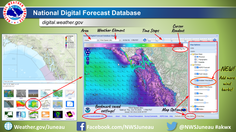
- Forecast graphics improvement: A new layer with additional wind barbs can now be added to forecast maps on digital.weather.gov. Please see the linked image to see how to navigate and add the new layer.
- NWS forecast pages underwent updates, effective April 30th. To learn more about the specific modifications and known issues, please click here.
- The new National Water Prediction Service (NWPS) is live and operational. This is replacing the Advanced Hydrologic Prediction Service (AHPS). AHPS will continue to function until May 27. Now is the time to update your links/bookmarks.
| NWS Forecast for: Icy Cape to Cape Suckling from 15 to 80 NM (PKZ672) Issued by: National Weather Service Juneau, AK Last Update: 328 AM AKDT Thu May 2 2024 | |
Today: E wind increasing to 25 kt. Seas building to 8 ft. Tonight: E wind 25 kt. Seas 10 ft. Fri: E wind 20 kt. Seas 9 ft. S swell in the morning. Fri Night: SE wind 20 kt. Seas 7 ft. Sat: SE wind 20 kt. Seas 8 ft. Sun: SE wind 20 kt. Seas 10 ft. Mon: SE wind 15 kt. Seas 9 ft. | |
| Zone Forecast: Icy Cape to Cape Suckling from 15 to 80 NM (PKZ672) | |
Visit your local NWS office at: https://www.weather.gov/Juneau |