

Flooding Concerns in Puerto Rico; Thunderstorms Across the Southeast U.S.
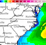
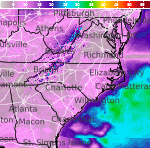
Showers and thunderstorms capable of producing widespread heavy rainfall will be possible across much of Puerto Rico today. Heavy rainfall will likely lead to flash, urban and small stream flooding. Some areas may face life-threatening flooding. In the Southeast U.S., strong to marginally severe thunderstorms will be possible this afternoon.
Read More...

Last Update: 1007 AM EDT Fri Apr 19 2024
For More Weather Information:
9NM E Currituck Beach Light MR
Marine Zone Forecast
Rest Of Today
NE winds 10 kt. Seas 3 to 4 ft, occasionally to 5 ft. Wave detail: NE 4 ft at 7 seconds and E 1 ft at 13 seconds.
Tonight
SE winds 5 to 10 kt, becoming S after midnight. Seas 4 to 5 ft, occasionally to 6 ft. Wave detail: NE 4 ft at 9 seconds. A chance of showers after midnight.
Sat
W winds 10 to 15 kt, becoming N in the afternoon. Seas 4 to 5 ft, occasionally to 6 ft. Wave detail: NE 4 ft at 10 seconds and SE 1 ft at 8 seconds. A chance of showers in the morning.
Sat Night
NE winds 5 to 10 kt, increasing to 10 to 15 kt with gusts up to 20 kt after midnight. Seas 3 to 4 ft, occasionally to 5 ft. Wave detail: NE 4 ft at 9 seconds and SE 3 ft at 8 seconds.
Sun
NE winds 10 to 15 kt. Seas 3 to 4 ft, occasionally to 5 ft. Wave detail: NE 3 ft at 4 seconds and NE 3 ft at 8 seconds. A chance of rain in the afternoon.
Sun Night
NE winds 10 to 15 kt. Seas 3 to 4 ft, occasionally to 5 ft. Wave detail: NE 3 ft at 7 seconds and NE 2 ft at 4 seconds. Rain likely.
Mon
NE winds 15 to 20 kt, diminishing to 10 to 15 kt in the afternoon. Seas 3 to 4 ft, occasionally to 5 ft. A chance of rain in the morning.
Mon Night
N winds 10 to 15 kt. Seas 3 to 4 ft, occasionally to 5 ft.
Tue
N winds 10 kt, becoming E in the afternoon. Seas around 3 ft.
Tue Night
SE winds 10 kt, becoming SW after midnight. Seas 2 to 3 ft.
Additional Forecasts and Information
Click Map For Detailed Forecast
ABOUT THIS FORECAST
| Last Update: | 1007 AM EDT Fri Apr 19 2024 |
| Forecast Discussion | |


