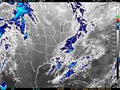
Synopsis...HIGH PRESSURE WILL CONTINUE TO INFLUENCE OUR WEATHER TODAY. A
SURFACE TROUGH APPROACHING FROM THE NORTHWEST WILL ARRIVE LATE
TONIGHT, FOLLOWED BY A COLD FRONTAL PASSAGE TUESDAY NIGHT. HIGH
PRESSURE BRIEFLY REGAINS CONTROL WEDNESDAY. LOW PRESSURE IS
ANTICIPATED TO MOVE QUICKLY FROM THE OHIO RIVER VALLEY ON THURSDAY
TO THE WATERS OFF THE MIDDLE ATLANTIC COAST ON THURSDAY NIGHT. HIGH
PRESSURE WILL FOLLOW EASTWARD TO THE MIDDLE ATLANTIC COAST LATER
FRIDAY THROUGH THE COMING WEEKEND.
Today...SW winds 5 to 10 kt...becoming S with gusts up to 15 kt this afternoon. Seas around 2 ft. Mainly in E swell with a dominant period of 7 seconds.
Tonight...SW winds 10 to 15 kt with gusts up to 20 kt. Seas 2 to 4 ft. Mainly in E swell with a dominant period of 9 seconds. A chance of showers and tstms late.
Tue...SW winds 10 to 15 kt with gusts up to 20 kt...diminishing to 5 to 10 kt late. Seas 3 to 4 ft. Mainly in E swell with a dominant period of 9 seconds. A chance of tstms early in the morning. A chance of showers in the morning...then showers likely with a chance of tstms in the afternoon.
Tue Night...W winds 5 to 10 kt. Seas 3 to 4 ft. Mainly in SE swell with a dominant period of 8 seconds. Showers likely with a chance of tstms early in the evening...then a chance of showers and tstms late in the evening.
Wed...W winds 10 to 15 kt. Seas 3 to 5 ft.
Wed Night...SW winds 10 to 15 kt. Seas 2 to 4 ft.
Thu...SW winds 15 to 20 kt...increasing to 20 to 25 kt in the afternoon. Seas 4 to 6 ft. Showers and tstms likely.
Thu Night...W winds 10 to 15 kt...becoming NE after midnight. Seas 4 to 6 ft. Showers and tstms likely in the evening.
Fri...NE winds 10 to 15 kt. Seas 4 to 6 ft.
Fri Night...E winds 5 to 10 kt. Seas 2 to 4 ft.
winds and seas higher in and near tstms.
|
  AVAN4 Avalon
Lat: 39.09°N Lon: 74.72°W Elev: 0
Not a Current Observation
| |

 
|
|


